The Back Bay is good at keeping secrets. It keeps its past well hidden behind its rows and rows of seemingly identical brick housing. Upon first glance, one would think that the Back Bay has not changed since its inception; that it has been frozen in time to preserve the quaint lifestyle of times ago. And in some ways this is true, this ageless feeling is very much present. But if you open your eyes and look closer, clues can be discovered, hidden among the homogeneousness. And quickly, a whole story is unraveled.
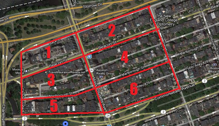 A google map of my site, for reference
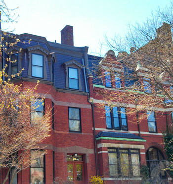
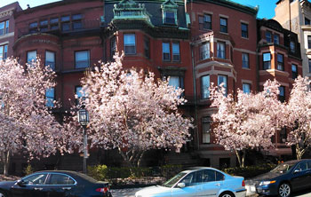
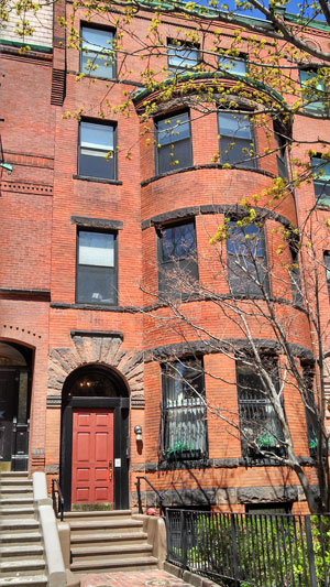 Typical building of the Back Bay
Walking around my site, everything looks congruous. The buildings are all of a similar size and style. All are thin, about 3 stories, with a bulging column of balconies. They are either made of brick or stone. Either they have flat roofs, or the roof is of a French style: tiled and with windows into the attic. But all of them the same.
There are exceptions, of course, but the overwhelming majority of these structures are of the same style. Most blocks in the Back Bay consist of the same type of row houses—I’ve learned to recognize this kind of pattern as a New England staple, typical of a city (having seen similar buildings in New York and other such areas). The reason it feels so “typical” is because the style has been around for so long. By now, it is expected and comfortable, the “norm”. Habits aren’t habits automatically; first, they are quirks and uniqueness. Then, by sheer repetition, they become typical and expected.
Thus it is for the architectural style of the Back Bay: it seems so typical now because it looks essentially the same as it did in the late 1800s when it was first constructed. Everything has remained essentially the same.
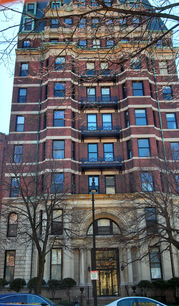 The Cambridge
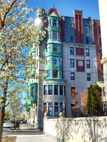
Taking a walk down Beacon Street, one of the most provocative buildings that catch your eye is the apartment complex on the corner of Beacon and Massachusetts Avenue, with its marble base and brick stories.
With 10 stories in height, it towers over its companions, which are 3 or 4 stories in height. This building is The Cambridge, an apartment complex. It first appears in a 1914 Sanborn map, which states that it was built in 1898 (see map below). Originally, it was built as an apartment complex, as well. Both façade and usage have remained unchanged since its beginnings.
A similar circumstance can be found one block over, on the corner of Marlborough and Mass Ave. It is, surprisingly enough, called The Marlborough.
Built in 1895, this building was probably constructed, like the last one, as an apartment building. A 1914 Sanborn map shows that, at least by this point, The Marlborough was officially an apartment building and it has remained so, through the years, into the modern day (see map below).
Both of these buildings demonstrate a very clear connection to the past. Like most buildings around them, these apartments look virtually the same as the day their construction was finished. And even more remarkable is the fact that their usage is still the same. One hundred years ago, these buildings were being used for the exact same purpose at they are now. The only thing that has changed is their inhabitants. Such a clear connection to the past, such a visible thread through time, is quite outstanding.
 1914 Sanborn map of The Cambridge
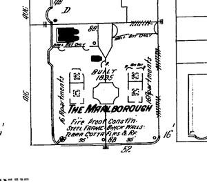 1914 Sanborn map of The Marlborough
 1887 Sanborn map of the block between Beacon and Marlborough Streets
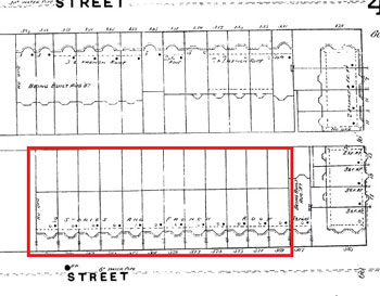
Progressing down Beacon, away from Mass Ave, one encounters more of the same brick row-housing. And then, at the end of the block, an interesting phenomenon: the housing here flips direction. Where there should be the last unit, instead there is the side and back of another row. The houses here don’t face Beacon, but turn to face Hereford Street.
When I first encountered this event, I thought that perhaps there had been on larger residence on the corner and, for whatever reason, it had been removed and replaced with these smaller units. But the 1887 maps show that they were planned to be oriented in this way. This arrangement is beneficial because it maximized land usage. Aesthetically, it provides a break from the rows and rows of similar brick housing. In this way, the residences wind down Beacon and flow into Marlborough, creating a continuous, harmonious loop. This allows the block to feel more like one unit instead of a piece in a monotonous and repetitive pattern.
 West blocks, 1895 Bromley map
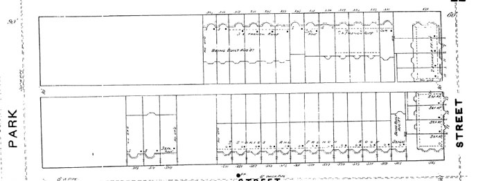
Throughout Marlborough, a detail that stands out is the roofs. These roofs, in the French style, are not uncommon—in fact, they are quite popular in the Back Bay.
The French style must have been in fashion during the Back Bay’s late 19th century construction. But on Marlborough, this style is especially prevalent.
Looking at the 1887 map, a large portion of the block is labeled as “2 stories and French roof.” The architectural style of these buildings, focusing specifically on the highlighted area, is not exactly the same.
 1887
1887 The modern buildings still clearly display a relic of their past in these roofs. They show the fashion of the period and maintain the sense of congruity that they were clearly planned for.
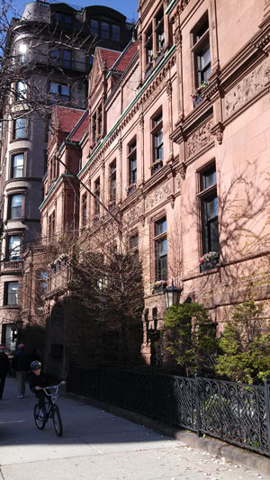
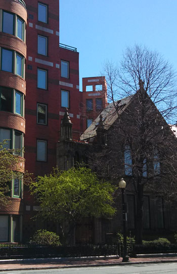 Cathedral or apartment building?
That’s not to say that nothing has changed:
For indeed, the most obvious marker of change is right across from The Cambridge (the aforementioned building on the corner of Beacon Street and Mass Ave).
This building looks like an apartment complex and an old cathedral have been welded together in some elaborate experiment. The building looks like a stone church that has been gutted out; its insides replaced with a brick apartment complex. The whole effect is very strange. Because the two styles are so completely different, it’s hard to really tell that they are the same building, until you take a closer look.
It is this oddity that drew to this site form the beginning, its weirdness evoking a strong pull. My historical maps run from 1887 to 1951, during which this site contained the Mt. Vernon Church. For over 50 years, the site consisted of this church, standing proudly amongst brick buildings.
So how did it go from a church to an apartment building? Had it been a planned demolition or an upgrade, the façade of the church wouldn’t have been left intact. If it had been part of a plan, the church would’ve probably just been completely torn down. But it wasn’t. So what happened?
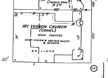 1951 Sanborn map of Mt Vernon Church
Sure enough, a bit of research shows that the church burned down in 1978. The wooden trusses (and benches and other assorted fire hazards) burned, while the façade remained untouched.
To preserve this remainder of a building that had been part of the neighborhood for close to a century, the new developed probably decided to integrate the new with the old. Thus, the modern product was conceived, a mash-up of a modern apartment complex with the relics of what used to be.
Clearly, the Back Bay merely has the semblance of a frozen timelessness. For in reality, a great amount has changed. Like a stylish, dignified Lady, the Back Bay shows no age.
 Views of the corner of Commonwealth and Mass Ave
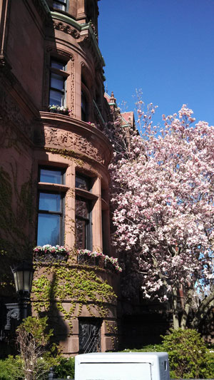
Such evidence of hidden change can still be found, such as the clue on the corner of Commonwealth Avenue and Mass Ave. This huge building is a single residence building. One family lived on this plot of land, which is roughly three times the size of the dwellings around it. The physical building has not changed since it first appeared in 1887, where it was meant to be a single-family dwelling.
The original owner, Olive Ames, seems to have owned it up until 1914. Then, by 1928, the building changed to be the National Casket Show Rooms. Despite his lucrative wealth, Olive Ames was unable to sustain this property, probably due to increasing prices and the beginning pangs of the Depression looming ahead.
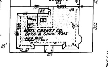 1951 Sanborn map
Whatever the cause, the building changed usage from residential to commercial. In the 1951 Sanborn map, the latest map I have available, the building is still the site of the National Casket Show Rooms.
But on its way to modern day, the property switched yet again, back to a residential place. Instead of being a single-family home, however, the property is now filled with high-class apartments. Located right on Commonwealth, the location is ideal and the rent must run rather high. Unlike the previous example of the Mt. Vernon church, this apartment building looks essentially the same as it did before its transformation. At least on the outside, there are no visible clues to indicate it past.
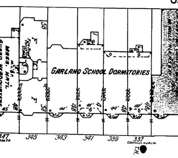 1951 Sanborn map of Garland Dorms
Proceeding down Commonwealth, I tried to look for what had become of these dormitories. Construed of four consecutive buildings, I was looking for a set of identical facades, joined together with a unifying trim. A private dormitory in the heart of Back Bay on Commonwealth Avenue is not exactly commonplace. A school that can afford such forms much be well-off and would want to show of the classic, upper class, New England style of cultured and dignified elegance.
 Modern day Garland
Built in 1887, these buildings were originally dwellings. An 1895 map shows that they were owned by different people, and thus have little to do with each other. For whatever reason, these residences were abandoned and turned into the dormitory some time after 1914 (at which point they are still labeled as dwellings). In the current day, these building are just regular homes. All of the history and change is completely invisible.
But not all change is equal:
The blocks to the right and left of Mass Ave have developed differently. The right side is more well-kept: the sidewalks are level, the streets cleaner, the buildings better maintained. There seems to be more care devoted to the right side. Why?
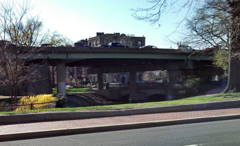 View of the overpass
The Charlesgate hotel was built in 1895, one of the earliest buildings to populate this side of Mass Ave. The Fensgate was built a bit later, in 1924. It was originally two dwellings that were then converted into a hotel.
Now, neither of these are hotels. A 1951 map shows that the Charlesgate Hotel became a Boston University dorm. And in the modern day, the Fensgate hotel turned into the Charlesview apartment. Before the overpass even went up, the whole neighborhood was in trouble, with the Great Depression quickly followed by the rise of suburbanization. But once the overpass went up, less care was devoted to this noisy, dirty area.
 View of The Charlesgate from the back
Indeed, the lots next to the Charlesgate dormitory is currently under construction, the buildings that used to be there have been taken down. This rare occurrence demonstrates the diminished concern for the preservation of this part of Back Bay.
On the other side of Mass Ave, it would be ridiculous and unheard of to have entire buildings simply removed. In general, however, the Back Bay’s changes are quick and only in program.
The building right next to the former Garland School Dormitories, the Lafavette Apartments, is one example. Originally the Empire Hotel, it was built in 1895. By 1914, it was an apartment building. Then, by 1928, it was a hotel once more. By 1951, and through present day, it is an apartment building. Similarly, the Boston University dorms located on Beacon Street were originally built as the Maryland Apartments.
Both show the fact that land usage has varied among the Back Bay. But more than this, they illustrate the fact that this neighborhood is unique in the fact that most of these changes are completely hidden. There are very few traces of the passing of time here. It is truly a neighborhood that has changed with the times, while keeping true to its original roots. The Back Bay is a mix of both modernity and timelessness. It is not irrelevant and antiquated, but rather a graceful transition between classic architecture and modern usage. A perfectly balanced act.
Bibliography
Sanborn Fire Insurance Map. Boston: 1887. http://sanborn.umi.com/image/view?state=ma&reelid=reel04&lcid=3693&imagename=00140&mapname=Boston%201885-1888vol.2,1887,%20Sheet%2041_a
Sanborn Fire Insurance Map. Boston: 1887 http://sanborn.umi.com/image/view?state=ma&reelid=reel04&lcid=3693&imagename=00140&mapname=Boston%201885-1888vol.2,1887,%20Sheet%2041_a
Sanborn Fire Insurance Map. Boston: 1914. http://sanborn.umi.com/image/view?state=ma&reelid=reel07&lcid=3693&imagename=00066&mapname=Boston%201908-1938vol.2,1914,%20Sheet%2038
Sanborn Fire Insurance Map. Boston: 1914. http://sanborn.umi.com/image/view?state=ma&reelid=reel07&lcid=3693&imagename=00066&mapname=Boston%201908-1938vol.2,1914,%20Sheet%2040
Sanborn Fire Insurance Map. Boston: 1951. http://sanborn.umi.com/image/view?state=ma&reelid=reel09&lcid=3693&imagename=00300&mapname=Boston%201929-Feb.1951vol.2,1937-Feb.1951%28North%29,%20Sheet%20221
Sanborn Fire Insurance Map. Boston: 1951. http://sanborn.umi.com/image/view?state=ma&reelid=reel09&lcid=3693&imagename=00300&mapname=Boston%201929-Feb.1951vol.2,1937-Feb.1951%28North%29,%20Sheet%20229